The short answer
Valbona Valley lies in Tropojë Municipality, Kukës County, in the Albanian Alps of northern Albania, also called the Accursed Mountains or Bjeshkët e Nemuna. Most visitors arrive from Shkodra, either by the seasonal Komani Lake ferry or on foot from Theth over the Valbona Pass, which is usually walkable from about June to October. Plan for early and late light, sudden mountain weather and marked trails.
Where is Valbona Valley?
Valbona Valley runs through Tropojë Municipality in Kukës County, in the far northeast of Albania, close to the borders with Kosovo and Montenegro. The nearest town is Bajram Curri, the municipal seat. The village of Valbonë and smaller settlements such as Rragam and Dragobi sit along the valley below the high peaks.
The mountains around the valley are the Albanian Alps. In Albanian they are Bjeshkët e Nemuna, which translates as the Accursed Mountains, and across the border they are known as Prokletije. The range is shared by Albania, Kosovo and Montenegro. Its highest point is Maja Jezercë at 2,694 meters, and the tourism agency notes that the Valbona River rises near it.
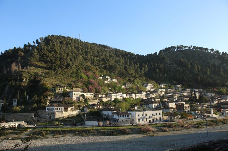
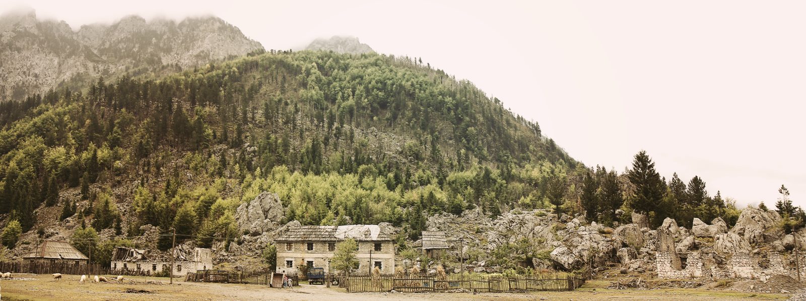
For a photographer, that means one long river valley walled in by limestone peaks, with small villages, stone houses and guesthouses spread along the road and the riverbed.
Is Valbona Valley a national park?
Yes. Valbona Valley was declared a national park in 1996, covering about 8,000 hectares, and since 2022 it has been part of the larger Alps of Albania National Park. The National Agency of Protected Areas (AKZM) manages the combined park, which joined Valbona, Theth and the Gashi River reserve into one protected area.
AKZM states that the Alps of Albania National Park was created by Council of Ministers Decision No. 59 of 26 January 2022 and covers 82,844.65 hectares, managed as an IUCN Category II national park. Expect to see both park names on maps and signs.
Nearby, the Gashi River valley in the north of Tropojë is listed by the tourism agency as part of the UNESCO World Heritage site for the ancient and primeval beech forests of Europe. Forests in the Valbona area are mixed, with beech, pine and oak, which matters when you plan for autumn color.
 Valbona Valley Village Panorama by Norik Uka
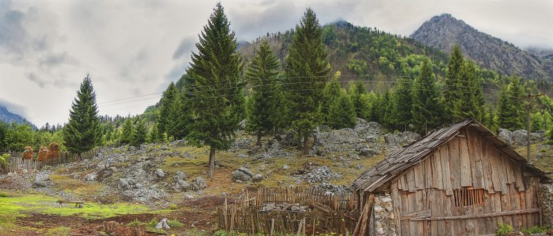 Wooden Cabin Below the Peaks of Valbona by Norik Uka
 Girl Looking Out Over a Valbona Village by Norik Uka
 Sheep Grazing Near Stone Houses in Valbona by Norik Uka
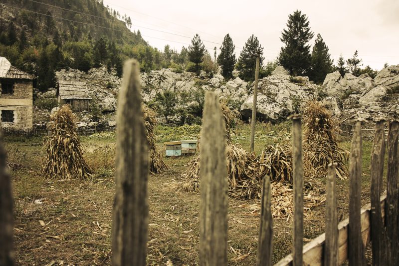 Wooden Fence and Haystacks in Valbona by Norik Uka
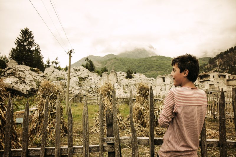 Boy by a Wooden Fence in Valbona by Norik Uka
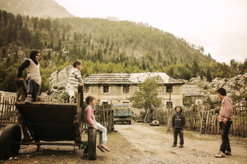 Children Playing on a Cart in Valbona Village by Norik Uka
 Aerial View of Shkodra and Its Rivers by Norik Uka
Every photo above is CC0 and free to use. More mountain views are on the landscapes topic page, and their makers are on the photographers page.
How do you hike from Theth to Valbona over the Valbona Pass?
The Theth to Valbona hike is a one-way crossing of the Valbona Pass that most guides put at six to eight hours of walking. Published figures for the pass differ: one Theth guide lists 1,759 meters and Wikipedia lists 1,795 meters, so treat it as roughly 1,760 to 1,800 meters. The route is marked with red and white waymarks.
The climb is steeper from the Theth side. A Theth guide gives about 850 meters of climbing from Theth and about 630 meters from Valbona, which is why some walkers prefer to start in Valbona. Reaching the pass takes roughly two and a half to three hours from either side. Fast hikers report less; photo stops add more.
For photography, the pass is the reason to go. On a clear day it gives views into both valleys. Carry water, a warm layer and a rain shell, because conditions on the pass can differ sharply from the valley floor.
| Detail | What reliable sources say |
|---|---|
| Pass elevation | 1,759 m to 1,795 m, depending on the source |
| Walking time, full crossing | About 6 to 8 hours for most hikers |
| Time to the pass | About 2.5 to 3 hours from either side |
| Climb | About 850 m from Theth, about 630 m from Valbona |
| Usual season | Roughly June to October, once snow has cleared |
| Waymarking | Red and white marks |
How do you get to Valbona from Shkodra?
From Shkodra there are two common ways to reach Valbona: by road and the seasonal Komani Lake ferry, or by road to Theth and then on foot over the Valbona Pass. Ferry and minibus timetables change by operator and season, so confirm them directly before you travel.
The Komani Lake ferry runs along the Koman reservoir between Koman, near the Koman hydroelectric dam, and Fierzë, near the Fierza dam. Travel guides agree that the service is seasonal, running roughly from spring to autumn, with little or no regular service in winter. From Fierzë, minibuses and transfers continue by road up to the Valbona Valley.
- Choose your direction. Ferry first and walk back to Theth, or Theth first and ferry back to Shkodra.
- Check the ferry season and departure times with an operator before you book anything else.
- Arrange the road leg from Shkodra to Koman, which travel guides put at about 1.5 to 2 hours on a winding mountain road.
- Book the onward transfer from Fierzë to your guesthouse in Valbona, since the ferry arrival is not in the valley itself.
- Check trail and weather locally the evening before walking the pass.
- Keep a spare day in case weather closes the pass.
The ferry is a photography trip in its own right, with steep forested walls close to the water. A fast shutter speed and a polarizing filter help with reflections and haze.
When is the best time to visit Valbona?
The best time to visit Valbona for hiking and photography is from June to October, when the Valbona Pass is usually free of snow and the ferry is running. The tourism agency notes that the park sees most visitors from May to September. Winter brings heavy snow, and the pass is not a winter route.
One detailed hiking guide reports that in recent years the crossing has only reopened around the second week of June. The UK government travel advice warns that from December to February severe weather can cause flooding in northern Albania and that heavy snowfall in the mountains can disrupt transport and services.
| Season | Conditions | Photography notes |
|---|---|---|
| Spring (April to May) | Snow still on high ground and the pass | Snow-capped peaks above green valley floor; pass usually closed |
| Early summer (June) | Pass reopens as snow clears | Strong river flow, fresh meadows, patches of snow near the pass |
| Summer (July to August) | Warmest months, busiest trails, afternoon storms possible | Start at dawn for clean light and quieter trails |
| Autumn (September to October) | Cooler, fewer visitors, season closing | Beech and mixed forest color, lower sun angle |
| Winter (December to February) | Coldest period, heavy snow, transport disruption | Pass not an option; valley travel only with local advice |
What light should you plan for in Valbona Valley?
In a deep valley like Valbona, the sun reaches the valley floor later and leaves it earlier than on open ground, so the peaks catch the first and last light while the river is still in shade. Plan around that gap, and use a sun-position app to check where light will fall.
| Time of day | What usually happens | What to shoot |
|---|---|---|
| Before sunrise | Soft, even light; mist possible over the river | River and stone houses with long exposures |
| Early morning | Sun on the upper peaks only | Lit summits above a shaded valley |
| Mid-morning | Light spreads down the slopes onto the valley floor | Meadows, trails, guesthouse yards |
| Midday | Hard light | Forest interiors, river clarity with a polarizer |
| Late afternoon | Valley floor falls into shade first | Backlit trees and grass, side light on rock walls |
| Dusk | Last light on high peaks, then blue hour | Silhouetted ridgelines, lit windows in the villages |
Summer afternoons can bring storms. Wait for dramatic cloud, but not at the pass.
What should you photograph in Valbona and nearby?
Valbona rewards photographers who look at both the big landscape and the small details: the Valbona River, the limestone peaks, traditional stone houses, guesthouse life and the autumn forests. The table below lists places named by official tourism and park sources, with the subjects each one suits.
| Location | Subjects | Notes |
|---|---|---|
| Valbona River | Clear water, braided gravel beds, reflections | The tourism agency describes it as about 50.6 km long and among the cleanest rivers in Albania |
| Valbona spring (Burimi i Valbonës) | Spring water, forest, moss | Listed by the tourism agency; a common stop on the way to the pass |
| Valbonë and Rragam | Stone houses, fences, hay, guesthouses | Villages inside the park; private homes, so ask before close-ups |
| Valbona Pass | Panoramas over both valleys | Summer and early autumn only |
| Dragobi and Dragobi Cave | Village life, cave entrance | Listed by the tourism agency in the Valbona Valley |
| Komani Lake | Gorge walls, water, boats | Seen from the seasonal ferry |
| Theth | Church, stone tower houses, valley views | The other end of the pass hike; the church dates from 1892 |
For guesthouse life, think in sequences: the yard in morning light, boots by the door, the view from the window. If you shoot mainly on a phone, the phone photography page covers settings that help in high-contrast mountain light, and the professional page explains how working photographers can share their work here.
How do you photograph people and private property respectfully?
Ask before you photograph people up close, and treat homes, yards and livestock as private property even when there is no fence. Many houses in the valley are family homes that also host guests. A smile, a gesture toward the camera and a clear yes or no is enough, and a no should end it.
Delete a picture if someone asks. Do not walk into yards, barns or hay meadows for an angle without permission, and with children, ask a parent first.
This matters for sharing too. Largephotos publishes under CC0, which waives copyright and related rights as far as the law allows. CC0 does not clear the rights of the people shown, such as privacy and publicity rights, and it does not clear rights in property or brands that appear in a frame. Our license page explains this and also states a Largephotos site rule against selling unaltered copies of photos. If you plan to upload portraits, get the subject’s agreement first.
Can you fly a drone in Valbona?
Drone use in Albania is regulated by the Albanian Civil Aviation Authority (AAC), and visitors should contact the AAC before flying, because the published guidance is written mainly for Albanian residents and businesses. Inside the national park, also check with the National Agency of Protected Areas.
The AAC states that Albania has adopted rules based on the European Union drone regulations, in force since July 2022. Its guidance sets a 120-meter height limit, requires visual line of sight, rules out flying over crowds and near airports, and sets a minimum pilot age of 16. Its registration rules apply to operators resident or doing business in Albania, and the page sets out no clear process for foreign visitors, so email the AAC drone desk listed on its website.
Even where flying is legal, a drone over a guesthouse yard or a grazing flock is intrusive.
How do you stay safe in the Albanian Alps?
Stay on marked trails, check the weather the evening before and again at dawn, and turn back if cloud, rain or snow closes in near the pass. Mountain weather can change quickly, and summer heat on the valley floor does not mean summer conditions at the top.
The UK government travel advice says there are still unexploded landmines in some remote areas around hill towns near the northern border with Kosovo. It advises hikers to follow warning signs, stay off uncultivated land and not leave marked paths. It also warns that rural roads are poor.
- Start early, especially in summer, to finish before afternoon storms.
- Carry more water than you think you need, plus rain and warm layers.
- Tell your guesthouse your route and expected arrival.
- Ask locally whether the pass is clear before you set out in June or October.
Why is Shkodra a good base for the Albanian Alps?
Shkodra, one of the oldest cities in Albania, is the usual starting point for both Theth and the Komani Lake ferry, so it works well as a base before and after the mountains. It also has strong subjects of its own, led by Rozafa Castle and Lake Shkodra, which are worth a day of their own.
Rozafa Castle stands on a rocky hill about 130 meters above sea level at the entrance to the city. The tourism agency describes its Illyrian origins and later building phases under Roman, Byzantine, Venetian and Ottoman rule, and it gives views over the city, Lake Shkodra and the meeting of the Buna and Drin rivers.
Lake Shkodra lies on the border with Montenegro and is the largest lake in the Balkan Peninsula. It drains to the Adriatic Sea through the Buna River. The Albanian part of the lake is a protected area and a wetland of international importance under the Ramsar Convention, and the tourism agency lists birdwatching among its activities.
See all 45 free Landscapes photos
For more mountain views, browse the landscapes topic.
Questions people ask
Where is Valbona in Albania?
Valbona is in Tropojë Municipality, Kukës County, in the northeast of Albania near the borders with Kosovo and Montenegro, inside the Albanian Alps.
How long is the Theth to Valbona hike?
Most guides put the one-way crossing at six to eight hours of walking, with roughly two and a half to three hours to reach the Valbona Pass from either side.
How high is the Valbona Pass?
Sources differ, giving 1,759 meters or 1,795 meters, so plan for a pass of roughly 1,760 to 1,800 meters above sea level.
Does the Komani Lake ferry run all year?
No. The ferry is seasonal, running roughly from spring to autumn, with little or no regular winter service. Check dates and departures with an operator before you travel.
When is the Valbona Pass open?
The pass is usually walkable from about June to October. Snow can linger into June, and it is not a winter route.
Can I use the Valbona photos on Largephotos for free?
Yes. They are published under CC0, so you can use them without credit, but CC0 does not clear the rights of people or private property shown, and Largephotos does not allow selling unaltered copies.
How this guide was written: facts were checked against official Albanian sources (the National Agency of Protected Areas, the National Tourism Agency and the Civil Aviation Authority), UNESCO, UK government travel advice and published trail guides, checked on 7 October 2026. Spotted an error? Write to admin@largephotos.net.